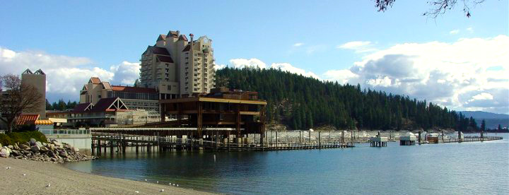
Our Monthly Averages for the Coeur d’Alene, Spokane area.
| Month | Avg. Precipitation | Avg. High (F) | Avg. Lows (F) |
| January | 3.94″ | 34.6 | 21.8 |
| February | 4.18″ | 38.2 | 25.8 |
| March | 1.92″ | 47.6 | 27.7 |
| April | 1.77″ | 58.2 | 33.9 |
| May | 2.44″ | 68.6 | 41.3 |
| June | 1.98″ | 75.9 | 48.0 |
| July | 0.71″ | 85.5 | 52.4 |
| August | 1.23″ | 84.9 | 51.9 |
| September | 0.94″ | 75.6 | 45.0 |
| October | 1.96″ | 61.4 | 37.3 |
| November | 2.77″ | 44.8 | 30.3 |
| December | 3.85″ | 37.4 | 26.3 |
 What is Coeur d’Alene?
A thriving resort community on the shores of Lake Coeur d’Alene in northern Idaho. Its defining image is sunny days, clear blue waters, pine-studded vistas and open spaces. Coeur d’Alene has become known as the playground of the Pacific Northwest for luxury accommodations and a wealth of recreation and attractions in a stunning natural setting.
Where does the name Coeur d’Alene come from?
It’s French. French traders named their trading post in respect for the tough trading practices of local Indian tribes. Translated literally, it means “Heart of the Awl” or possibly “sharp-hearted.”
Elevation:
Coeur d’Alene is 2,152 feet above sea level
Population:
The population of Coeur d’Alene is 42,579 and the population of Kootenai County is 142,357. – U.S. Census 2012
How do I get there?
Coeur d’Alene is easy to reach, located off Interstate 90 only 40 miles away from the Spokane International Airport, served by non-stop daily flights from cities including Chicago, Minneapolis, Denver, Phoenix, Los Angeles, San Francisco, Portland, Seattle, Boise, Vancouver, Calgary and others.
The Coeur d’Alene Airport provides charter and private air service, with the capacity to land 34-seat passenger planes. There are vans, taxis, rental cars and shuttles available from both airports.
Missoula, Mont. is 180 miles to the east, and Seattle, Wash., is 330 miles to the west. The Canadian border is 90 miles to the north.
